cut to add later version Happy National Read a Road Map Day! cuts to add back in later

In this blog today, we will look at just a handful of maps intended to whet your appetite. Of course we would be happy to show you around our map collection and we do offer a free outreach program on historic maps and mapmaking for local schools and community groups,


x
this on map
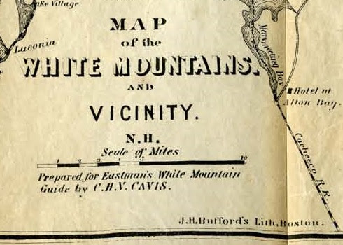
"Prepared for Eastman's White Mountain Guide by CHV Cavis". "Entered according to Act of Congress in the year 1872 by E.C. Eastman. 2 copies. (Nov 30, 2019 only one copy there)
Note: This map is broken into pieces. FRAGILE keep level!
question this "Map of the White Mountains and Vicinity, New Hampshire". From Drake's White Mountains, Their Legends and Scenery, 1882.
x


DESCRIPTION
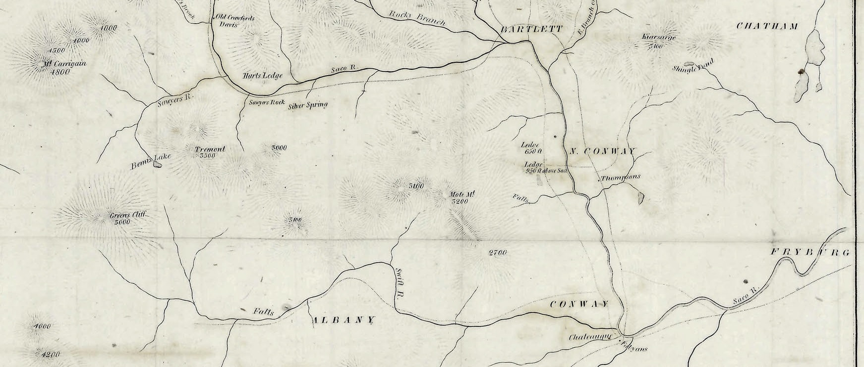
This fascinating and highly detailed map of the White Mountains was prepared by C.H.V. Cavis and lithographed in Boston by the New England Lithograph Company in 1872. It was originally published in the 10th edition of Eastman’s White Mountain Guide, published in Concord by Edson C. Eastman (also in 1872).
The longevity of the publication, printed annually beginning in 1861, reflects continued interest in the region as an outdoor retreat and summer resort area. Primary transportation routes, settlements, and certain accommodations are noted throughout the map, while topography is depicted in hachure. Numerous mountain peaks are labeled with their name and height.
The accompanying guidebook includes nearly 250 pages of text, plates, and charts describing in detail the region’s climate, geography, and accessibility. An additional fold-out map is present, showing the various railroad routes connecting the White Mountains to the rest of New England.
MAP DETAILS
Publication Date: 1872
Author: C.H.V. Cavis
Sheet Width (in): 11.50
Sheet Height (in): 14
Condition: B
Condition Description: Moderate wear and creasing along former fold lines, including separation at fold intersections that have been repaired on the verso. An additional jagged 2" hole, lower left, and two 2" tears on the left side, has been closed and repaired on the verso. Paper has curled slightly around the outer edges, but overall remains in good condition. Includes a copy of the 1872 Eastman's White Mountain Guide in good condition. 248 pp. + 8 pp. of advertisements bound in original gilt brown covers. Owner's inscription of Mrs. Emma Pulk Simons, July 9 1873.
$125.00
DESCRIPTION
This fascinating and highly detailed map of the White Mountains was prepared by C.H.V. Cavis and lithographed in Boston by the New England Lithograph Company in 1872. It was originally published in the 10th edition of Eastman’s White Mountain Guide, published in Concord by Edson C. Eastman (also in 1872).
The longevity of the publication, printed annually beginning in 1861, reflects continued interest in the region as an outdoor retreat and summer resort area. Primary transportation routes, settlements, and certain accommodations are noted throughout the map, while topography is depicted in hachure. Numerous mountain peaks are labeled with their name and height.
The accompanying guidebook includes nearly 250 pages of text, plates, and charts describing in detail the region’s climate, geography, and accessibility. An additional fold-out map is present, showing the various railroad routes connecting the White Mountains to the rest of New England.
MAP DETAILS
Publication Date: 1872
Author: C.H.V. Cavis
Sheet Width (in): 11.50
Sheet Height (in): 14
Condition: B
Condition Description: Moderate wear and creasing along former fold lines, including separation at fold intersections that have been repaired on the verso. An additional jagged 2" hole, lower left, and two 2" tears on the left side, has been closed and repaired on the verso. Paper has curled slightly around the outer edges, but overall remains in good condition. Includes a copy of the 1872 Eastman's White Mountain Guide in good condition. 248 pp. + 8 pp. of advertisements bound in original gilt brown covers. Owner's inscription of Mrs. Emma Pulk Simons, July 9 1873.
$125.00
1 in stock
now let's go way back in time, from the future,
…that the Turin Papyrus is thought to be the oldest recorded road map in the world? Historians believe that it was created around 1160 BC.
History Of Read A Road Map Day
history of ...
.jpg)
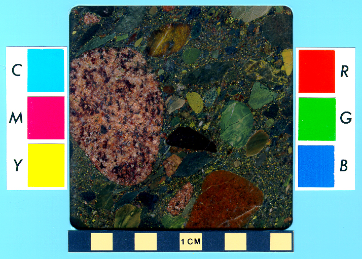
The map shows the landscape along a wadi, the Arabic name for a dry valley in the desert. The profile of the mountains is projected onto both sides of the valley. Inscriptions describe the "Mountain of the Gold”, the “Mountain of the Silver”, but also the location of the “Village of the Miners”, the "Mountain or Temple of Amun", the streets to the (Red?-)Sea and a street to the (today lost) city of Ta-menti. The different colors shown on the map are inspired by the real colors of the rocks, reddish-pink feldspar-granite (Fawakhir-Granite), dark Atalla-Serpentinite and blue-green Hammamat-Sandstone, and yellow for the sand of the desert. The river follows the entire valley, eroding and transporting the rocks, as shown by the pebbles with different colors in the riverbed. A quarry of bekhen stone, the sandstone used to carve the statues, is shown, as are many veins of gold. The most important indication was the location of a well near the village. Thanks to this well, the archaeologists identified the area shown on the map. The ancient mountains of gold and silver are situated along the Wadi Hammamat, near Bir-Um-Fawakhir, an ancient miner settlement, almost 62 miles east of Luxor. Following the indications of the map into the field, the archaeologists discovered ancient signs of mining, like 160 feet deep tunnels following massive quartz veins. The most important veins are also shown as undulating lines in the Turin-map. The gold is only rarely found als large crystals of native metal, it is quite more common to find the gold as tiny fragments distributed randomly in the massive quartz-rock, almost invisible to the naked eye.
The Turin-map, of course, is more of a treasure map or topographic map with indications for miners, as it is a true geological map. The rocks are not identified or described in detail, and the map contains no stratigraphic information at all. Nevertheless, it´s a unique document, a beautiful and rare testimony of the keen practical and geological observations of the ancient Egyptians.
x
from here.
x
In addition to being the oldest topographical map, the Turin Papyrus Map is also the earliest known geological map because it showed the local distribution of different rock types, the diverse wadi gravels, and contained information on quarrying and mining.
x
x
the following from here.
x
x
Turin Papyrus Map, c.1150 BC
Kate Wiles surveys one of the world's oldest surviving maps, prepared for a quarrying expedition led by Ramesses IV.
Kate Wiles | Published in History Today Volume 66 Issue 8 August 2016
It shows a 15km-stretch of the Wadi Hammamat, the ‘Valley of Many Baths’, oriented with south and the source of the Nile at the top. Shown on this portion of the map are a quarry for bekhen stone, a prized blue-green material used to carve statues of gods and pharaohs, and a gold mine. Nestled at the foot of some hills (stylised cones with pink, wavy flanks) to the north are four small houses for gold-workers, which are close to a temple to the god Amun. The map also shows the locations of various rock types, including gold-bearing quartz, which is represented by three pinkish stripes on the hill at the top, above the gold mine. Inscriptions elsewhere describe the purpose and destination of the quarried stone.
x
the following from here.
best detailed toledo article
x
x
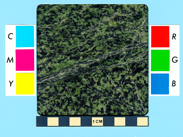
focus of turin map is rocks, geology


z


Comments
Post a Comment